| Author |
Message |
jP
Rio Banditos


Diddle Fuerte Diablo !
Joined: 15 Oct 2005
Online Status: Offline
Posts: 4404
|
   Posted: 10 Jul 2012 at 3:22pm Posted: 10 Jul 2012 at 3:22pm |
|
Yeah, sorry-- i'm a little too good at that (rubbing people the wrong way online) I guess the best we can do with this open source style of info is participate in it to the degree it is important to us.
Anyone on these forums who has a favorite run or two should periodicly check the description page and check the info posted their against their own personal knowledge. If info is way off base, it should be changed directly on the rivers page where it will be reviewed by a "rio bandito", or challenged in the forums much like in this discussion.
We all just have to know ourselves and where we sit along the spectrum, and be aware that this beta is to serve the whole paddling community, and not just us as individuals. Like I said, I consider myself moderate both in how I rate the class of rapids and how I guage the river in terms of "low","medium", and "high". People from both extremes will likely disagree. My "medium" is generally relative to the river's medium in any riverbed:
Tons of rocks in the riverbed= low.
Rocks moderately covered yet the water is comfortably contained within its bank = medium.
Bank full is obviously high.
Yes it is subjective, but not as much as ALL OF OUR egos pretend it is.
See the river as it is with unbiased eyes. Observe nature. The river will tell you what IT considers low, medium, or high.
|
 IP Logged IP Logged   |
|
|
JoesKayak
Rio Banditos

Joined: 07 Nov 2006
Online Status: Offline
Posts: 1245
|
Posted: 10 Jul 2012 at 3:25pm |
Originally posted by jP
Oh wait:
I'm going to choose e) These numeric values are all highly subjective. And I, as a free thinking individual, value all of the resources I have available to me. I understand that merely clicking on a web link and recieving a numeric value is by itself an absurd means of determining whether or not a section of river or creek contains the suitable amount of water for me based on my skill level, sensibilities, fitness level, ect. That for any guage reading to effectively convey any meaningful information to me whatsoever, it is entirely encumbant upon myself to learn and understand a broader tapestry of details including but not limited to the location of the guage, the current whether positions relative to the actual averages for that calendar day or week, the season(s) and how they influence. runoff, ect. Furthermore, I would prefer to have multiple resources that differ in their beta so I can better figure it out for myself, rather than several resources that all parrot one another. It is up to me and me only to know myself in this sport, know my local runs of interest, and know my resources and how to interpret them.
Well said, JP. I think a lot of boaters out there would benefit greatly to doing their homework. There's a lot more to it than just looking for a green light.
|
|
IP Logged |
|
|
PaddleGirl
McNasty


Joined: 18 Oct 2010
Online Status: Offline
Posts: 266
|
Posted: 10 Jul 2012 at 3:38pm |
Originally posted by jP
Yeah, sorry-- i'm a little too good at that (rubbing people the wrong way online)
thanks, though also not necessary... i agreed with everything you said but for whatever reason my ego was a little bruised.
when i moved from the east coast, i expected there to be a bigger discrepancy in class ratings than i think there is. The bigger difference, in my opinion, is the low, med, high ratings. one person's medium is my high, their high is my "no effin way", my low is their "ELF - no effin way".
just an observation that one person's high max. rec. level can be another person's min. rec. level.
and i'm sure as i progress and/or get spoiled with having such an abundance of water all year long, things will evolve.
|
|
IP Logged |
|
|
jP
Rio Banditos
Diddle Fuerte Diablo !
Joined: 15 Oct 2005
Online Status: Offline
Posts: 4404
|
Posted: 10 Jul 2012 at 3:48pm |
|
See, now with the color analogy, I disagree with you, Jay. Low, medium, and high are both measurements.
While whether or not you prefer orange or blue is a preference that really has little importance beyond aesthetics. My argument has always been that the low/medium/high debate needs to be rooted in the river's hydrological and fluvial rthyms, rather than simply being a matter of preference arbitrarily left up to a group of individuals to decide on. Yes, it is a preference.
So is how much salt you put on your food. But if you don't have standards to meassure it, how can you be sure it'll taste good for ya?
And of course we can all agree that's at the heart of what we are discussing. I'm just saying it shouldn't be left to Elf Boater X's opinion and his merry band of low water wingnuts. Nor should it be left to Floodstage Freddy and his Fratternity of class Five Freaks to opine about what they think defines the three brackets of the spectrum. It should be left to the river.
Then we have our guages. And, we have the cup rock. From this, we have the cupdate, and thousands of words typed by PPeeps describing how to interpret it to your liking. But until USGS puts an online guage up in there, we are stuck with this visual guage. Its been described in great detail. Verbally, with photos, ect. So after all this I'm hard pressed to see any problem here (with regard to FITW).
Paddlegirl has, through this process, sparked a possible worthy topic about how to correlate PP w/ AW. But that would be its own topic, and to get anywhere with it we'd have to delve deeper than the initial observation of some dicrepencies and move forward with spotlighting the top five worst or something. Then take a fresh look on a community level and make those five river descriptions more accurate. But that takes more mental effort than an online community devoted to whitewater can muster, perhaps? If so then we have to be happy with the imperfect info we have, which is already arguably too much.
I tried to get community involvement with this stuff a few times, and it ussually fizzles out. Its up to all of us to participate, otherwise just accept what ends up as the default.
All I know is that we are lucky to have all kinds of water coursing through these cracks in the mountains. It still flows downhill, just like yesterday, and I'm about to go get some!
|
|
IP Logged |
|
|
jP
Rio Banditos
Diddle Fuerte Diablo !
Joined: 15 Oct 2005
Online Status: Offline
Posts: 4404
|
Posted: 10 Jul 2012 at 4:14pm |
|
If you prefer Low water, you are still paddling on low water! You aren't paddling on "medium" flows because you prefer low water and your base line reference is medium to you. It shouldn't work like that. What's low then from that reference point? Bone dry? Because 400 on the East Frk Lewis is absurd. I have never heard of it being paddled that low.
If you prefer UBER HIGH f**king FLOODSTAGE MADNESS, but are boating on a run at a medium flow, you are not boating on "low" water because it is low relative to your preference. You are boating on medium water based on what that drainage is designed to discharge.
It may be as widely subjective as you all seem to assert, but it shouldn't be. Have you seen William Nealy's book KAYAK?
He's got a page in there that illustrates what I'm saying. I've seen similar illustrations on nature kiosks along hiking trails. That's what I'm saying when I refer to the three brackets.
Now, the cruel irony here that actually destroys my own argument can be illustrated with a hike through the tunnels into Robe. If you go down to the stretch after the tunnels where Hotel California sits, and look at the river when it is runnin, lets say, 5.6' (what we consider as paddlers a medium flow) you will possibly observe like I have that it is actually kind of "low" for the riverbed itself. Looking at the canyon and how many rocks are exposed, how nested deep in the trench all the water actually is, its clear that the S. Fork Stilly is designed to carry a lot more water. And we know it does. Those Robe Gnomes don't move all those house sized boulders around by themselves. They use the water to help them.
But for most whitewater runs, an unbiased look at nature's hydrological and fluvial effects generally indicate what low, med, and high are. Its a bit more standardized than most of us think.
|
|
IP Logged |
|
|
Travisimo
Big Boofer

Joined: 17 Jun 2005
Online Status: Offline
Posts: 598
|
Posted: 10 Jul 2012 at 10:21pm |
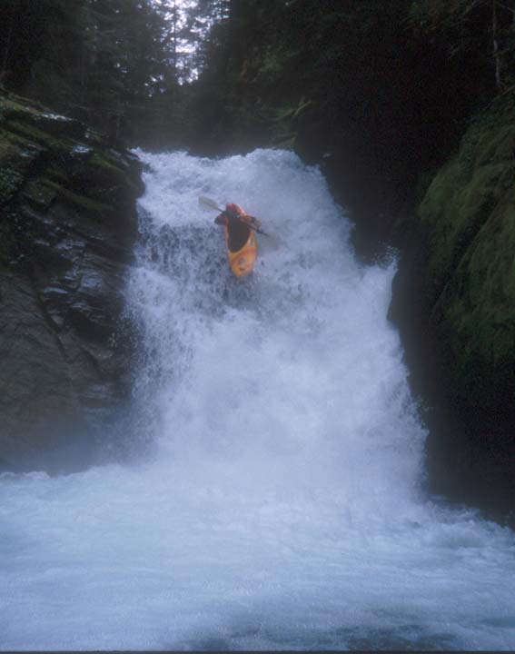
How did we get to Robe? I just say that you cannot rate "Fall in the Wall" unless you fall into the wall. I have never seen anyone run it at the PP "fat-high" and certainly not "soiled undies"!!! I'd love to see video though, and I'll hold the camera and rope anytime!  When I said "new" boaters maybe I should have said new boaters to that run, because that's what I mean. At low flows FITW is perfect for new class V paddlers. At "medium" not so much. I just don't want people thinking that FITW is some evil run. It was one of my first V's and is an awesome low stress day at low flows. I know people have gone up there recently and been scared off, maybe forever. That sucks. If you are comfortable with the falls at the beginning, I'd say you'll have a good time on the run. If you're a gnar boater, that level will increase.
Edited by Travisimo - 10 Jul 2012 at 10:37pm
|
|
H2O please
|
|
IP Logged |
|
|
huckin harms
Master Poster


Joined: 03 Nov 2005
Online Status: Offline
Posts: 1477
|
Posted: 11 Jul 2012 at 8:01am |
JP has made some important points here. One that I found most interesting is the observation we all can make about a river's capability to carry water and our ability to judge it's level based on it's capability for carrying it. Look at the Sky... the benett book declares 5k the high end for running the Sky. Now most of us know that the Sky has been run way higher, say 45k higher, and that would be considered high by anyones standard. But if you look at the riverbed at say 5-6k it is clear that its still low for the rivers carrying capacity. 10k is much closer to a medium for the river itself, where the waters fill in most of the banks nooks and crannies, yet theres still plenty room for more water to rise. Travis, who cares if somebodies been 'scared' off from running FITW for life. IF so then maybe this isn't the hobby for them. IF it is truly classV then maybe they should be scared off and that's a good thing. IMO true classV in its essence is going to be scary and nervous nancy's need not apply. Come back when your resume is ready or look elsewhere for your fix. It's not for everybody and if it were I'm pretty sure some of us would be looking for something else to do. Low lows FITW is not class V. And Travis, what's this fascination with that janky waterfall at the top. Why do you feel like it's 'got' to be included in the run?
|
|
IP Logged |
|
|
James
Admin


Sum Dum Guy
Joined: 31 Dec 2004
Online Status: Offline
Posts: 3595
|
Posted: 11 Jul 2012 at 8:39am |
|
Being nestled sky high in between the lush cleavage of town wall and haybrook does not give you northerners the right to call our local goodies "Janky"
|
|
IP Logged |
|
|
Jed Hawkes
Rio Banditos

Joined: 24 Aug 2008
Online Status: Offline
Posts: 814
|
Posted: 11 Jul 2012 at 9:51am |
|
Something to consider about the sky is that the only thing that makes 10k scary is Boulder drop, at 10k the rest of the run is nice and filled in and really a perfect medium. But BD being an outlier changes the way we look at the run. That is also a common thing on other rivers with outlier drops that change the way we look at the run (ie husum falls, white salmon).
|
|
The line will become apparent
978-273-7723
|
|
IP Logged |
|
|
Travisimo
Big Boofer
Joined: 17 Jun 2005
Online Status: Offline
Posts: 598
|
Posted: 11 Jul 2012 at 10:02am |
|
It is interesting to hear that what a river can hold should be used for the level. Interesting, but I disagree. Many runs, like the Muddy Fork of the Cowlitz through Stevens Canyon are suicide unless they are super low... Where I do agree that the river itself is low, when I talk to kayakers or look at "levels" I want to know what it can be run at, not how full the riverbed is.
As far as my fascination with the waterfall... it's fun, it's the name of the run, and I feel like the "acceptable" level has been pushed up by cutting it out of the run. As one of my first waterfalls I will always think of it as part of the run.
I just love FITW and want to see more (capable) paddlers on it, go get it!
Edited by Travisimo - 11 Jul 2012 at 10:42am
|
|
H2O please
|
|
IP Logged |
|
|
Sam_Graftton
Splat Wheeler


Joined: 21 Aug 2008
Online Status: Offline
Posts: 149
|
Posted: 11 Jul 2012 at 11:09pm |
|
Is FITW still high?
|
|
IP Logged |
|
|
JD_G
Splat Wheeler
Joined: 23 Apr 2010
Location: United States
Online Status: Offline
Posts: 138
|
Posted: 12 Jul 2012 at 7:42am |
|
Call it med-high last night. Maybe a couple inches of the downstream point showing.
|
|
IP Logged |
|
|
JoesKayak
Rio Banditos
Joined: 07 Nov 2006
Online Status: Offline
Posts: 1245
|
Posted: 12 Jul 2012 at 8:07pm |
|
Crazy to think mid July FITW has not yet come down to the friendly levels yet this season. Most years it is over and done with by now for a couple weeks.
|
|
IP Logged |
|
|
ellsw121
Paddler


Joined: 27 Jul 2010
Online Status: Offline
Posts: 76
|
Posted: 12 Jul 2012 at 11:22pm |
Cupdate at 6:30 pm today. 
|
|
IP Logged |
|
|
JayB
Big Boofer
Joined: 21 Feb 2005
Online Status: Offline
Posts: 505
|
Posted: 12 Jul 2012 at 11:33pm |
|
Having a hard time interpreting that (thanks for posting the picture, though!) - looks like everything but the upper edge of the cup is buried in that pic? Crazy for mid July if that's the case....
|
|
-Jay
|
|
IP Logged |
|
|
ellsw121
Paddler
Joined: 27 Jul 2010
Online Status: Offline
Posts: 76
|
Posted: 13 Jul 2012 at 7:44am |
|
Your correct, picture is turned wrong i just needed to rotate it. perfect medium level.
|
|
IP Logged |
|
|
BrianP
McNasty
Joined: 26 Sep 2010
Online Status: Offline
Posts: 344
|
Posted: 19 Jul 2012 at 1:35pm |
|
Water is well below the cup, maybe 6-8 inches below? Sorry no picture. Still boats though, a lot less grinding than it looked like there would be.
|
|
IP Logged |
|
|
flowtorch
Paddler

Joined: 04 Jul 2011
Location: Djibouti
Online Status: Offline
Posts: 67
|
Posted: 19 Jul 2012 at 2:45pm |
|
FYI, I'd like to paddle FITW on FRI FTW on my way to the Cooper. Har har har.
Anyone wanna get it semi early? I'm from CO and have never run it so I dont mind a little low flow scraping. Within reason.
|
|
IP Logged |
|
|
JayB
Big Boofer
Joined: 21 Feb 2005
Online Status: Offline
Posts: 505
|
Posted: 06 Aug 2012 at 10:21am |
Originally posted by chipmaney
the wood was tied up last year, for what reason it's unclear. i agree whoever tied it up should remove the rope, otherwise the log will never transport itself downstream and will continue to be a navigation impediment. In addition, I think the log has moved farther downstream than it's original tied position and is more in the thalweg than last year, when it seemed to be contained in the eddy. Tied log has been removed. It's now un-tethered and sitting fairly high up out of the water on the right bank. Any water high enough to dislodge it should be high enough to flush it over Franklin falls.
|
|
-Jay
|
|
IP Logged |
|
|
Travisimo
Big Boofer
Joined: 17 Jun 2005
Online Status: Offline
Posts: 598
|
Posted: 07 Aug 2012 at 1:31pm |
|
Thanks! That thing sucked.
|
|
H2O please
|
|
IP Logged |
|
|
 Active Topics
 Memberlist
 Search


